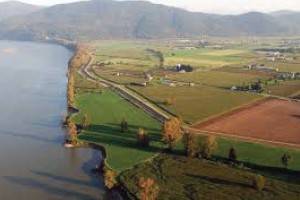
Sustainable Development & Freshwater Quality in Canadian Rivers
/0 Comments/in Construction Landscape Journal, Environment, Sediment Control, Slope Stabilization, Streambank Restoration, Sustainable Development /by Tanya RichardsIn our quest for sustainable development, a major consideration must be maintaining the water quality of our streams, rivers and other water sources. These water sources support plant and animal habitats, as well as human commercial, industrial and recreational activities.
The following article on freshwater quality trends in Canadian rivers was originally posted on the Environment Canada website but has been reproduced below for your convenience. As mentioned below, a key factor affecting the quality of water in Canadian rivers is the amount of rain and snowfall during the year, which can carry soil and pollution through runoff and leaching into the rivers. The way that construction development is performed greatly affects the sustainability of our rivers for the long term.
As the article concludes, one important factor in reversing water quality trends in our rivers is to build the health of stream banks by planting native vegetation and trees. Another important part of ensuring the long-term establishment of this vegetation is to rejuvenate and stabilize the soil with compost-based soils and growing mediums, as with Denbow’s Terraseeding service.
Freshwater Quality in Canadian Rivers
The Freshwater Quality in Canadian Rivers indicator is designed to provide an overall measure of the ability of select rivers across Canada to support aquatic life.[1] It integrates multiple pressures from human activity upstream of water quality monitoring sites to present freshwater quality in the regions where the majority of Canadians live.[2]The indicator focuses on rivers with higher risks to water quality and provides Canadians with an indication of human impacts on freshwater quality.
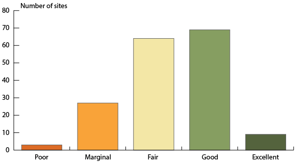
For the 2010 to 2012 period, freshwater quality in Canadian rivers where human activities are most concentrated was rated:
- excellent or good at 45% of monitoring sites,
- fair at 37% of sites,
- marginal at 16% of sites, and
- poor at 2% of sites.
Overall, freshwater quality in Canadian rivers can maintain healthy river ecosystems.
National freshwater quality indicator, Canada, 2010 to 2012 period
The bar graph presents freshwater quality rating in rivers selected to be representative of the regions of Canada where human activities are most concentrated for the period 2010 to 2012. The bars show the number of sites where freshwater quality was rated excellent (9), good (69), fair (64), marginal (27) and poor (3). Ratings are based on data from 172 monitoring sites.
Note: Freshwater quality was assessed at 172 sites on select rivers throughout 16 of Canada’s drainage regions where human activity is most intensive using the Canadian Council of Ministers of the Environment’s Water Quality Index.
Source: Data assembled by Environment Canada from federal, provincial, territorial and joint water quality monitoring programs.
Clean freshwater is an essential resource. It provides habitat for aquatic plants and animals, supports many commercial and industrial uses, and is at the heart of many recreational activities. Impaired water quality can undermine both aquatic ecosystem health and economic activities, such as fisheries, tourism and agriculture.
Freshwater quality varies naturally across Canada because of the country’s diverse geology and climate. It is further shaped by the ways in which people have developed the land around rivers and lakes. Each freshwater quality monitoring site has its own unique geography and set of human pressures.[3]
The rivers included in the indicators are selected to be representative of the drainage regions in Canada where human activities, such as industry, agriculture, urban growth and recreation, are most concentrated. The potential impacts of these human activities mean that these rivers are generally considered to have a higher potential for water quality impairment. At each site, physical properties of water, such as temperature, and levels of chemical substances, such as nutrients and metals, are measured and compared to freshwater quality guidelines. The more often a freshwater quality measurement is above its guidelines, the lower the freshwater quality rating will be.
Change in the national freshwater quality indicator through time
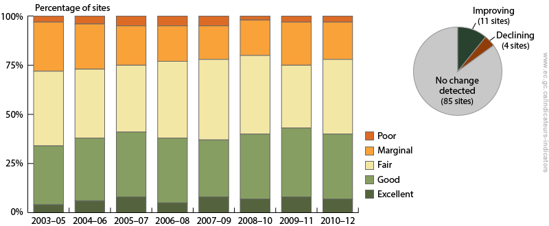
Between 2003–2005 and 2010–2012, there was an increase in the percentage of sites rated good or excellent and a decline in the percentage of sites rated poor or marginal.
Overall, the freshwater quality scores have:
- improved at 11 sites;
- declined at 4 sites; and
- showed no change at the remaining 85 sites.
National freshwater quality indicator, Canada, change between 2003–2005 and 2010–2012
The bar graph shows the percentage of sites where freshwater quality was rated excellent, good, fair, marginal and poor between 2003–2005 and 2010–2012. The inset pie chart shows the number of sites where the freshwater quality indicator has improved, where it has deteriorated, and where no change was detected. Between 2003–2005 and 2010–2012, the freshwater quality indicator rankings have improved at 11 sites and declined at four sites. No change was detected at 85 sites.
Note: Change in the indicator between the 2003–2005 and 2010–2012 periods was assessed at 100 sites in 16 drainage regions across Canada where historical data are available. For each site, change in the indicator was assessed using a consistent set of water quality guidelines and parameters through time.
Source: Data assembled by Environment Canada from federal, provincial, territorial and joint water quality monitoring programs.
Freshwater quality is affected by rain and snow which controls how much water runs off the land or leaches through soils. It is also affected by pollution released directly into it or that travels across land and through the air. Urban growth, agricultural practices and industrial development impact how water moves across the land and change water quality along the way. These multiple pressures on water quality mean freshwater quality trends are slow to change.
The decline in water quality can be reversed by upgrading wastewater treatment plants, adopting environmental farming practices, or planting native vegetation, such as trees, along rivers.
Save
Erosion Control on Steep Slopes and Embankments
/6 Comments/in Environment, Erosion Control, Municipal and Infrastructure Journal, Sediment Control, Streambank Restoration, Water Abatement /by Tanya RichardsErosion Control
As land development happens in hilly countryside, more erosion control on steep slopes and embankments is needed. Especially in areas that experience heavy rainfall. Steep slopes and embankments that have no vegetation or cover are especially vulnerable to erosion issues. Erosion can cause damage to not only the landscape, but any infrastructure surrounding the project. It is important to protect the hillside from erosion during and after the project is complete.
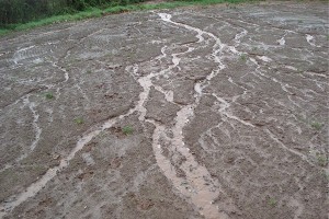
Erosion is basically the displacement of soil from one area to another. On steep slopes and embankments erosion is caused primarily by water, especially by heavy rainfall. Rain that falls onto the exposed ground dislodges soil particles which are then carried away down the slope by the flowing water. However, it is the resulting destabilization of slope that creates an even greater danger as rocks and trees roots become exposed.
There are several ways of controlling erosion on steep slopes and embankments.
Natural Solutions
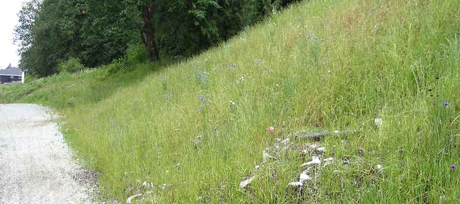
The most effective, natural way to control soil erosion on steep slopes and embankments is to plant vegetation. Not only will the grass, fescue and leaves help to slow down raindrops as they fall, the roots of the plants will also help to hold the soil together, making it harder for water to wash it away.
However, when planting vegetation on a slope to stop erosion, you need to keep in mind that what you’re planting is just as important as the planting. Though grasses can create a groundcover that can absorb some moisture, they have less effective storm water filtration ability compared to native ground cover. Various typical erosion control seed specifications are available as well as custom seed blends to mimic the native grasses in the area.
Artificial Solutions
Other than planting vegetation, there are also a variety of artificial solutions you can use. For instance, the use of geomats has become popular over the last few years. Geomats are water permeable polymers that are used to help fix soil elements, grass and small plant roots, and have been shown to work extremely well, especially on barren slopes that have no vegetation. There are even biodegradable geomats that are now being produced that are designed to prevent erosion and give freshly planted vegetation a chance to grow.
Building Terraces
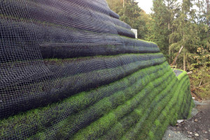
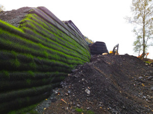
Building terraces is also another way to help prevent soil erosion. When most people think of terraces as a method of erosion control, some may think of the incas in Peru. There the natives implemented the early methods of erosion control on the Andes mountains for many centuries. Terrace walls help to hold soil in place while providing a convenient surface to plant a variety of plants. Building terraces can be as simple as using a couple of wooden blocks to create a terrace wall, or it could be more sophisticated and involve the use of engineered stones, concrete retaining wall blocks or a living green wall solution.
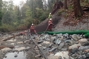
Soil Composition Enhancement
You could also control erosion by controlling the soil itself. As heavy rain tends to be the biggest culprit for soil erosion on slopes and embankments, by controlling the composition of the soil, you could control the effect that water has on it and therefore the likelihood that it will be eroded. Soil that is high in organic material tends to absorb more water, therefore, using organic material such as compost, aged mulch, or a manure can go a long way in preventing soil erosion.
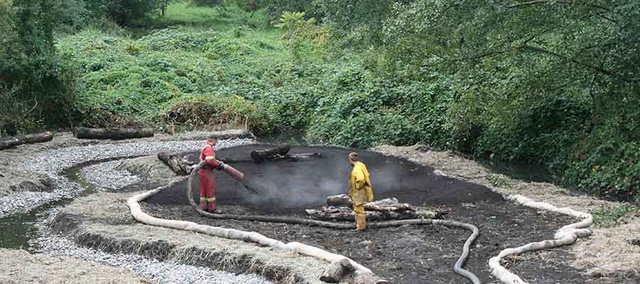
The best solution (or multiple solutions) is best determined by evaluating each slope individually.
Save
Best Erosion Control Practices
/6 Comments/in Environment, Erosion Control, Stormwater Management, Water Abatement /by Tanya RichardsBest Erosion Control Practices
With any kind of construction, you are bound to face challenges with controlling erosion and the deposit of sediments. The possibility of erosion is elevated by changes being made to the environment of the site. Water runoff contributes to the deposit of sediments and increased pollutants. These negative environmental impacts can all be kept at bay if a few Best Management Practices are implemented at the right time. We’ve outlined these best erosion control practices below for your reference.
Consider Unique Site Attributes
First you must carefully assess the site that you are working on, as every site is unique. Everything from the intensity, duration, and frequency of rainfall needs to be considered, as does the local geography and landscape. Sites that are on a slope or an incline will be more prone to erosion. The type of soil that the site is on must also be assessed. If the site is on soil that is very easy to erode, more drastic steps may have to be taken to reduce or stop erosion.
Develop a Project Plan
Once the site has been assessed, you can develop your erosion control plan. Taking care especially when it comes to the order in which different tasks are carried out. For instance, if you are carrying out construction over a wide area, you can begin excavating areas of the site in sections. Systematically move through different areas using a predetermined route, rather than disturbing the whole site. This will help reduce the amount of land that is left exposed for long periods, thereby decreasing erosion.
Managing Water Flow
Controlling water on your site will also be very important. The construction of dikes and ditches to control the flow of water is prudent, especially when they are constructed at the top and bottom of slopes and embankments. Constructing temporary slope drains will also help in mitigating the effects of erosion, especially when these are constructed in cut/fill transitions and steep slopes around the site.
Sediment that runs off a construction site can cause damage to the environment if it ends up in the wrong place, especially if it ends up in water ways surrounding the site. This could upset the ecosystem. Constructing silt fences and sediment traps will go a long way to preventing potential damage to the environment during to construction. Sediment controls should be constructed around the perimeter of the site, at the entrances and exits to the site, and at water inlets and outlets.
Managing Water Pollution
Reducing water pollution caused by erosion and sediment should be a high priority on site. This involves ensuring that a construction site near a water way has the proper erosion and sediment controls in place. If there is to be excavation then it is important to prevent erosion and sediment loss. Prior to the beginning of construction you can put filter sock in place around the edge of the water way. This will protect the water from any heavy sediment run off throughout construction.
Stabilization of soil, on site, after construction may also be necessary. One of the best ways to ensure that you maintain good soil stability is by protecting the existing vegetation that is on the site, including trees, shrubs and forbs. Areas where there is no longer any vegetation can be treated with a seeded compost erosion control blanket – controlling erosion and re-vegetating the area in one step.
Conclusion
In order to best address erosion and sediment controls, it is necessary to first, asses your site. Second, you must develop a project plan. Finally, implement your plan by managing water flow, using engineered structures and protecting the natural vegetation, thus reducing water pollution.
Overwhelming? We recommend partnering with an Environmental Consultant who is familiar with the Erosion and Sediment Control bylaws in the municipality where the project is located. eg: City of Surrey bylaws
We hope you find this article helpful. Please share!
Save
Erosion Control – Ineffective Methods and What Actually Works
/8 Comments/in Erosion Control, Municipal and Infrastructure Journal, Sediment Control, Slope Stabilization, Sustainable Development /by Tanya RichardsNew construction creates conditions that have the potential to cause slope destabilization, dangers to wildlife and fisheries habitats; stormwater runoff increases and results in increased sedimentation. Careful erosion control planning is required to ensure environmental stewardship and safety for generations to come.
In defining an effective approach to erosion control, one should take into consideration both the long-term effectiveness as well as financial feasibility.
The following approaches and methods of erosion control have proved to be ineffective for various reasons:
- Inadequate site assessment. Though not an end solution, the site assessment is critical when determining which method is used. When important aspects of the site conditions are not taken into consideration, inappropriate “solutions” may be prescribed.
One example of a site condition is the steepness of the slope. The erosive forces of runoff increases with both slope gradient and distance down slope and therefore erosion is typically at it’s maximum at the lowest part of the steepest slope section. Not recognizing or taking into account the destructive force of water during seasonal runoff in scenarios with significant slope and distance will result in ongoing and increasing site erosion.
- A focus on sediment control (managing sediment that has already eroded) instead of focusing on the root of the erosion problem through prevention.Though silt fences and other sediment barriers may be effective in keeping stormwater and fisheries habitats from undue sedimentation, the approach should only be used temporarily. Filter socks like Denbow’s Filtersoxx can be used both as a temporary sediment barriers but also as part of a more comprehensive deployment of erosion control products. Single application solutions, not comprehensive. These methods may provide partial or temporary results but are often not effective for the following reasons:
- Engineered structures – Though usually immediately effective, engineered structures like block retaining walls, do not adapt to changing site conditions, can become progressively weaker over time and are often the most expensive solution. For this reason engineered structures are not always the best method of erosion control.
- Adding rip rap to ditches to minimize/slow runoff. In some scenarios with minimal run-off, rip rap can be effective but in instances with significant water speed and sedimentation, erosion control is not mitigated.
- Adding vegetation alone, without a structural component. Though grasses can create a groundcover that can absorb some moisture, they have no slope stabilization benefits have less effective storm water filtration ability compared to native ground cover.
Erosion Control Solutions that Work
The solution to these incomplete and ineffective methods is to combine them into a comprehensive bio-structural approach. This approach includes engineered structural components that are paired with natural, vegetative products that will adapt and grow within the site structure over time. Starting with expert consultation to identify the appropriate method, the following are a few combination solutions available for different applications.
- Similar to hydroseeding, but providing much more of the underlying structure needed to prevent erosion, Terraseeding uses compost-based soils and growing mediums. During the Terraseeding process, seed is injected directly into the soil compost mixture as the material is blown into place, providing optimum moisture and nutrient availability.
- Denbow’s Kicking Horse Canyon Park Bridge project in Golden is an perfect example of combination solutions that utilized Terraseeded EcoBlanket and Filtrexx Rip-rap Grout installed to address erosion and to vegetate extremely steep slopes.
EcoBlanket – On areas with a slope of 50% or less, EcoBlanket is uniformly applied directly at the soil surface with a pneumatic blower as specified by Rexius. Typically applied at a depth of 1 to 2 inches, but application depth can vary depending the site requirements. In extreme conditions and where specified by the Engineer, EcoBerms or FilterSoxx may be added and constructed at the top of the slope and in parallel intervals down the profile of the slope if necessary.
- Extreme slope erosion may require a natural retaining wall solution for reinforcing slopes like Cascadia Green Wall, which allows for natural buffer zone design and water gardens. It is a cost effective solution when compared to concrete, block, gabion retaining walls.
Contact Denbow for an erosion control solution that stands the test of time.
Save
Save
Rain Gardens at Tsawwassen Mills
/0 Comments/in Construction Landscape Journal, Environment, Green Infrastructure, Municipal and Infrastructure Journal, Stormwater Management, Sustainable Development /by Tanya RichardsErosion Control vs. Sediment Control
/0 Comments/in Construction Landscape Journal, Environment, Erosion Control, Municipal and Infrastructure Journal, Sediment Control, Sustainable Development /by Tanya RichardsThe overarching principle of Erosion Control vs. Sediment Control is that it is much easier and cheaper to prevent erosion from occurring in the first place than to try and remove the sediment once it has eroded.
Erosion and Sediment Control is a rapidly changing field. Traditional approaches have been applied with varying levels of success over the years. In addition, there are a host of new approaches, practices, and proprietary products that should be shared, understood, and considered on construction and municipal sites. Sites can be sustainably managed by minimizing the impact of earthwork using proven erosion and sediment control measures..
Erosion Controls are source controls designed to prevent erosion from occurring. Solutions include seeding solutions like hydroseeding and terraseeding, wood chip mulch and rolled erosion control products.
Sediment Controls are downstream controls designed to remove sediment from runoff. Solutions include sediment fences and barriers, filter socks and other forms of mechanical filtration.
At the detailed design stage impacts can be minimized through efficient earthworks and erosion and sediment control measures. It is vital that development be successfully completed in balance with the natural environment.
The Erosion and Sediment Control Association of British Columbia is a non-profit organization is dedicated to increase the level of expertise in the Erosion & Sediment Control field throughout British Columbia. Their list of Best Management Practices are divided into Erosion Control and Sediment Control solutions that we think you will find useful.
Protecting Fraser Valley Dykes from Erosion
/1 Comment/in Environment, Erosion Control, Municipal and Infrastructure Journal /by Tanya RichardsProtecting Fraser Valley Dykes from Erosion of the Fraser River Banks
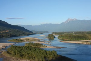
Starting in the Rocky Mountains, and pouring into the Strait of Georgia, the Fraser River is B.C.’s longest river, and largest flowing into the Pacific seaboard of Canada. The Fraser is a busy river: it is home to sturgeon, a provider of water for pulp mills, and in the Fraser Valley, its banks neighbour rich farmland.
After settlers came to the Fraser Valley, they were met with the power of the Fraser River. 1894 brought a disastrous flood to the region when the area had no defense against the rising waters of the river. A dyking system was soon created, but in 1948, with lack of care for the aging dykes, and the banks protecting them, another even more consequential flood, devastated the region, with an equivalent of over $200 million in damages.
In 2013, new erosion on the banks of the Fraser River raised an alarm. Existing erosion arcs, where strong currents had worn down the soft silt at the bottom of the riverbank, were monitored, and advancing development of a new arc called for immediate action, as it was only 30 meters from the dyke; the spring freshet could mean a repeat of history for the area. The dyke was protecting over 12,000 acres of diverse agricultural land, the historic Clayburn and Matsqui villages, land belonging to the Matsqui First Nations, and major regional infrastructure, such as gas mains, water transmission main, and the wastewater treatment plant. Flooding of this area would have even greater negative impact than it did over 60 years ago, an estimated $2 billion in damages.
The city of Abbotsford called for help, and made an emergency repair in early 2014 on the bank using rock armoring, or riprap, providing a new boundary for the river’s flow. Use of riprap is beneficial, as it deflects the impact of the current, absorbing the energy of the water, and therefore protecting the bank. It also slows the flow of water, and provides further protection from debris that the river might be carrying.
An example of such work can be found in Denbow’s Strachan Point project, where Charles Creek erosion was a threat to a CN Rail bridge, the highway bridge, and two private bridges providing access to local homes. Building up and widening the creek bed, and then reinforcing with the process of rock armoring, eliminated the threat.
Long-term, the Fraser Valley has more work to do to fight erosion. Since the 2014 fix, two new erosion arcs have developed. The city of Abbotsford engaged the services of Northwest Hydraulics Consultants to undertake a study on the Fraser River erosion. Their findings urged the city to not only continue the upgrades to existing bank protection with rock armoring, but also to utilize rock spurs.
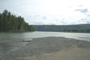
Rock spurs are linear structures, placed at the bottom of the bank, to assist in changing the direction of the river’s flow. This would slow the process of erosion drastically, by moving the force of the water away from the bank toe, which is where erosion arcs begin.
The city approved the proposed project in December 2015, with an estimated $8 million price tag. In April 2016, British Columbia’s Ministry of Transportation and Infrastructure announced $4 million will be provided for the project from the 2016 budget. While the Fraser Valley continues to fight to protect its land and livelihood from the power of the Fraser River, the Ministry has further committed to collaborating efforts to ensure the communities with potential impact are kept safe; work on upgrading the dykes themselves will also be prioritized.
Protecting Fraser Valley dykes from erosion of the Fraser River banks, proactive measures need to be taken. Erosion control will ensure infrastructure remains sound, homes are protected, farms flourish, and our historical sites live on.
Landscape Design: A Beautiful Wall
/0 Comments/in Construction Landscape Journal, Landscape, Municipal and Infrastructure Journal, Slope Stabilization, Sustainable Development /by Tanya RichardsRain Water Harvesting
/0 Comments/in Environment, Landscape Journal /by Tanya RichardsRain Water Harvesting
British Columbia rain: too much in the winter, too little in summer
The “leftcoast” gets a lot of rain in the winter, so much it causes problems like flooding, sewer overflows, stream erosion, and polluted runoff into our waterways. But during our summer we get very little rain (less than Tucson, Arizona!).
So it’s hard to store enough water from spring rains to last long for summer irrigation. You need large cisterns or multiple rain-barrel systems to store enough water to have an impact on water usage. Simple practices like amending soil with compost, mulching, and smart watering are the first steps to storing and conserving water. The next step is capturing all that beautiful rain water that falls on our wet coast.
How much rain water can I catch?
The lower mainland of BC averages about 1,200 mm of rain per year, but 2/3 of it falls from November to March. Most areas in the region average less than 87 mm total rainfall for July and August.
The roof of your home is your greatest tool to harvest rainwater. To determine the amount of rain your roof catches, multiply your home’s width by its length (in feet) to estimate its footprint. Then estimate the portion of this area that drains to the downspout you’ll be using to catch your rain.
To calculate the runoff in liters from a metal roof’s 9 meter 10 meter “footprint” (90 square meters) in a climate averaging 304 millimeters of rain a year:
90 square meter roof 304 millimeters of average annual rainfall = 27,360 liters of rain falling on the roof in an average year.
90 m2 304 mm = 27,360 liters/average year
Multiply the above figure by the roof surface’s runoff coefficient 0.95*: 27,360 liters 0.95 = 25,992 liters running off the roof in an average year.
Storing Rain Water
Storing your harvested rainwater can be your greatest challenge. However, most homeowners don’t have room to store the thousands of gallons of collected rainwater that they use in landscape irrigation through our dry summers. Plus the cost of installing storage containers with enough volume to give you water through the entire summer would be very cost prohibitive and it would take a very long time to see the cost savings pay off it off.
Capacity and cost are directly related: decide how much you want to spend on building rainwater storage. Couple with this the practice of using mulches to regulate the soils moisture content and evaporation and you’re on your way to saving money and water throughout our hot summers and help you save water.
Vancouver Area Average Monthly Rainfall
Month | Jun | July | Aug | Sept | Oct | Nov | Dec | Jan | Mar | April | May | June |
Rainfall (inches) | 11 | 20 | 67.8 | 41.8 | 112.8 | 170.8 | 230.2 | 167.2 | 130.4 | 161.6 | 24 | 51 |